This is our first full day on Faial. Yesterday we caught the 09:00 ferry out of Velas and about two hours later arrived at the far more impressive pier in Horta. Horta is definitely a more active city than Sao Jorge. While some buildings near the shore are in need of TLC many other places seem quite well kept. We found some nice little parks, a great pastry shop, and overall enjoyed our 3 miles of strolling.
Today we tackled the so-called volcanic badlands walk. There is a higher elevation route but because we thought descents would be more modest we decided to do the lower option.
The taxi dropped us off at a small market at Capelinhos Crusiero. The morning was bright and clear and we began our walk along a tarmac road uphill passing small white stucco homes. We soon reached a dirt road and turned left. A waymarked trail appeared that we thought might go where we wanted but our directions didn't mention it. We climbed on.We are pretty sure that the marked trail on the left as we climbed from below is a new trail but our way also worked.
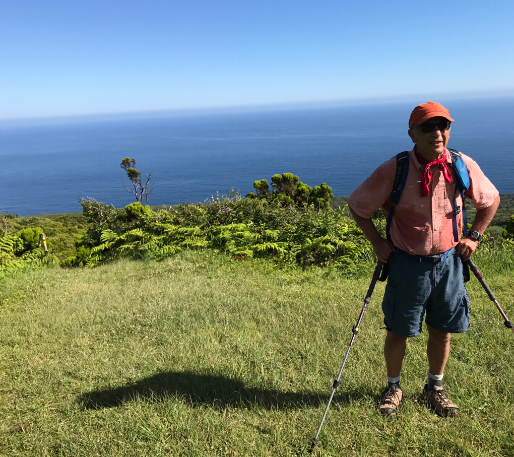
Up we went. In time we found the grass and dirt trail that we would now descend. It was still a great morning and we had some fine vistas.
Down we went. Nowhere near as steep as the descent of walk 2 or the kilometer of rock strewn path just above Ouvidor but you'll know you did it. It was, however, a pretty trail through forest. But when we reached a forest road confusion returned. Between our maps, digital and paper, we sorted ourselves out and continued down an increasingly overgrown
track to a paved road. It's at this point we think the higher route would go a different way. We eventually found a paved road and, at last, several kilometers into the hike, got a glimpse of the volcanic badlands.
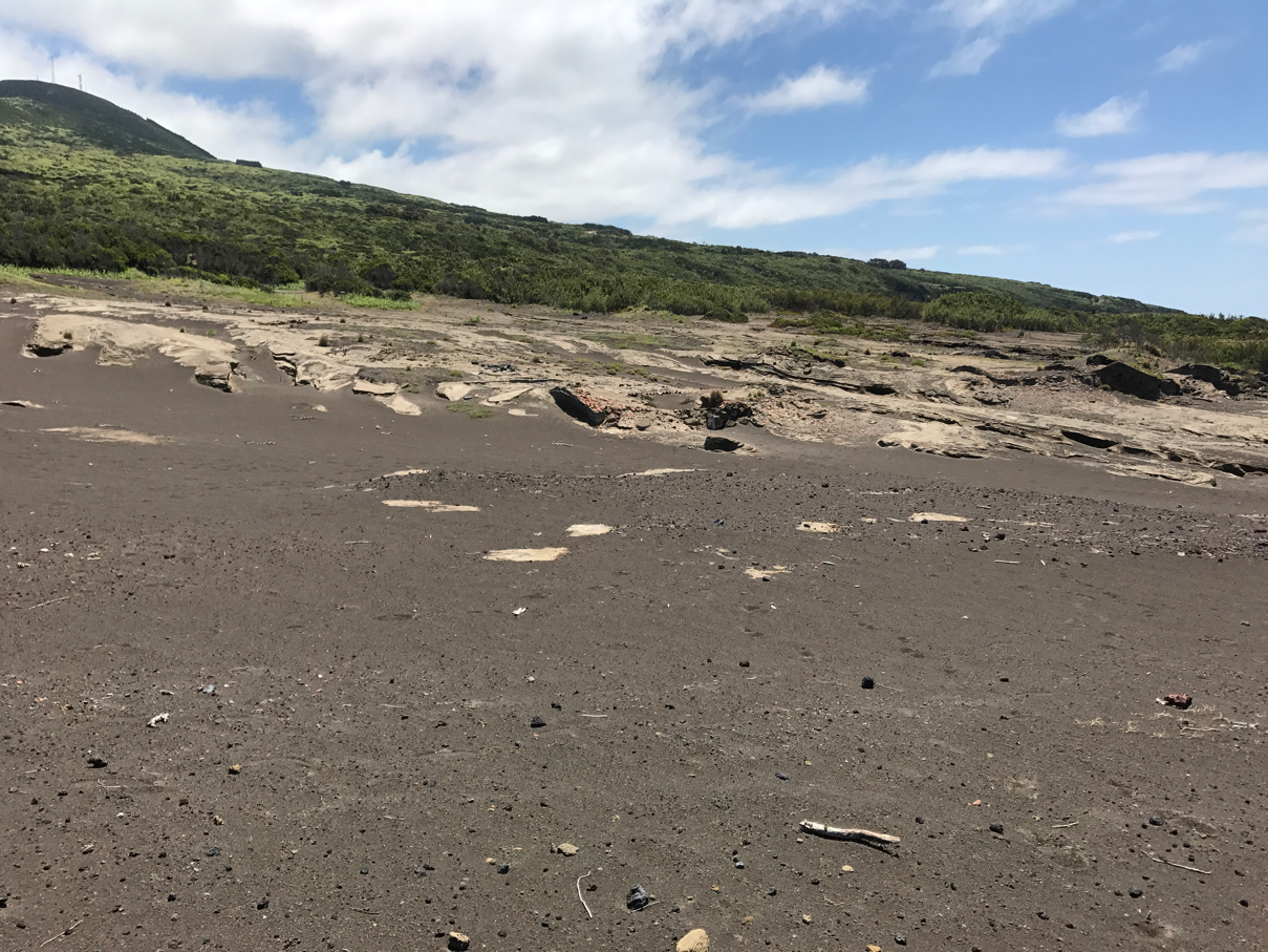
In 1957 the volcano Capelinhos began erupting. A large chunk of the island was affected and at least one major whaling station was buried by ash and abandoned. I didn't get a sense of how much damage was done but I believe it was substantial. Emigration to the USA, helped in large measure by JFK getting quotas greatly raised, soared. Today the area surrounding a large lighthouse looks like a lunar landscape though less filled with the black lava we saw on Lanzarote but instead is an all-covering gray ash. The visitor center is definitely worth a visit.
But this quick look at the results of the 1957-58 volcanic eruptions was the end of the best parts of today's hike. Soon we were striding down a dirt road that provided a view now and then but was basically bland. 2km in a red and white lighthouse relieves the monotony but then you trod another 3.5km past a infrequent homes, dull views, and no shade. It's an easy walk into the village of Varadouro but since there isn't much there (a small swimming area and small cafe).
In all, better to stop at the volcano visitor center and call for a taxi from there.
About the Photos
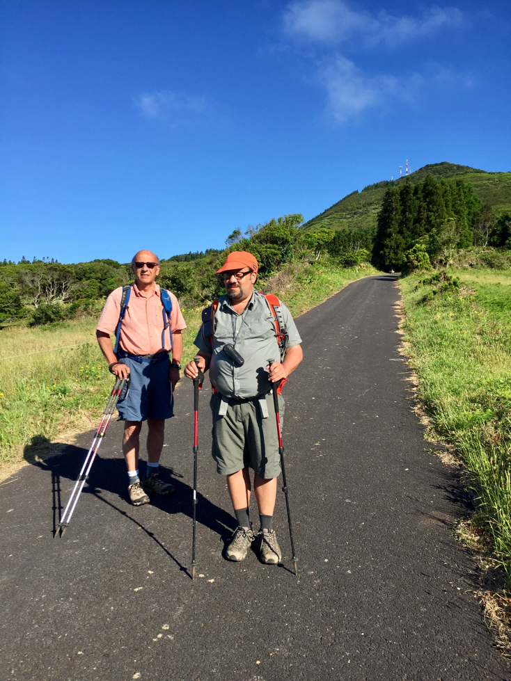
Photo 1 , by Mom, is at the start of our climb. It's a fine morning.
Photo 2: We are descending a moderately steep stretch of trail. This grassy bit is just a pause, a gap, in the forested slope. Along the way we passed by a lava tube entrance and around a great dip in the land where trails went both ways around.
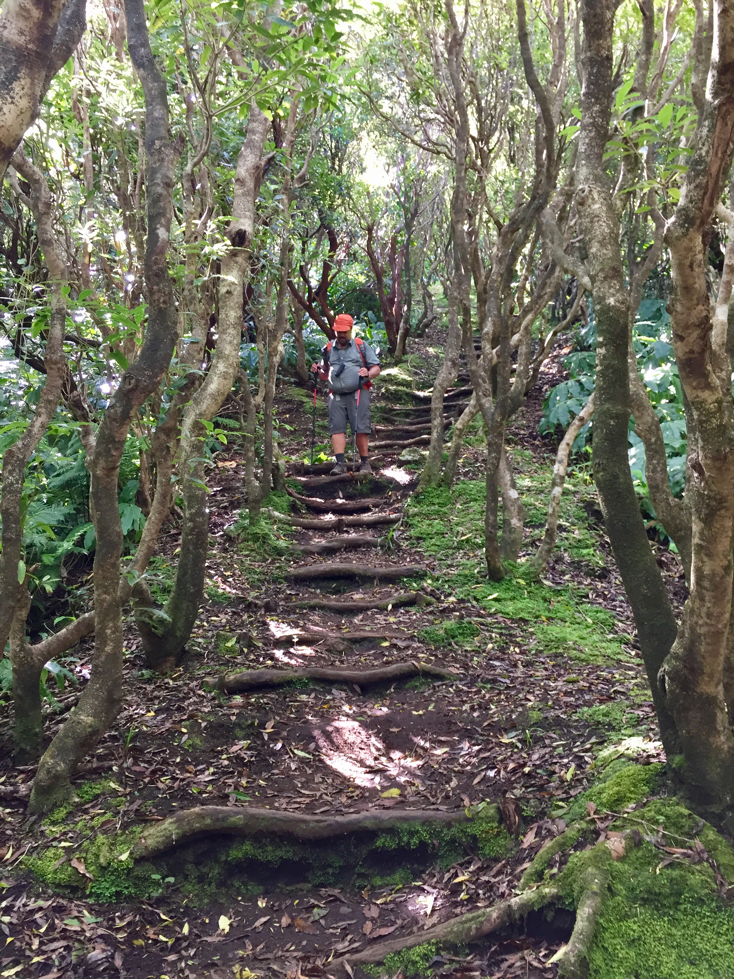
Photo 3 , taken by Mom, shows the start of the bulk of the descent. The log steps would be replaced by dirt and rock trail. Far easier travel than what I found on walk 2.
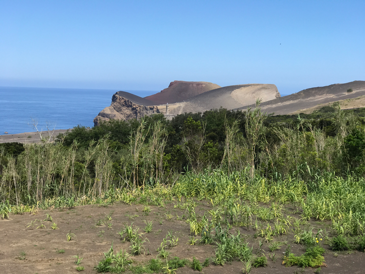
Photo 4 looks north north east towards the newest land in the Azores. The 13-month eruptions of Capelihos created over 2 square kilometers of land. A lot of it has since eroded into the sea.
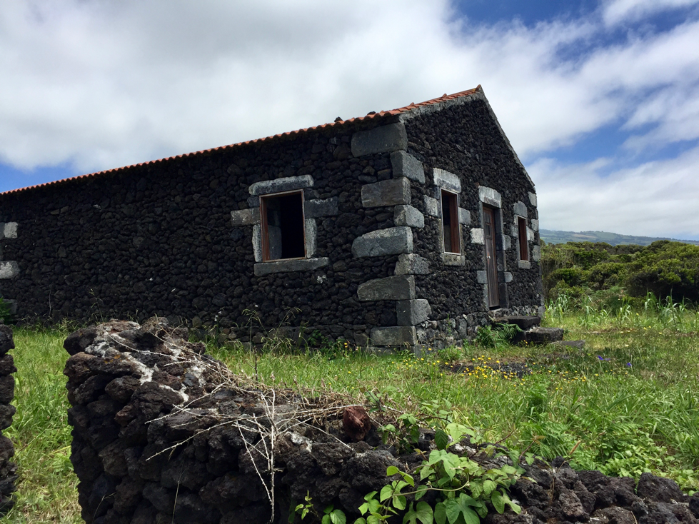
Photo 5 shows what remains on f a whaling station. Whaling was still thriving in 1957 but the volcano buried this group of homes to the rooftops.
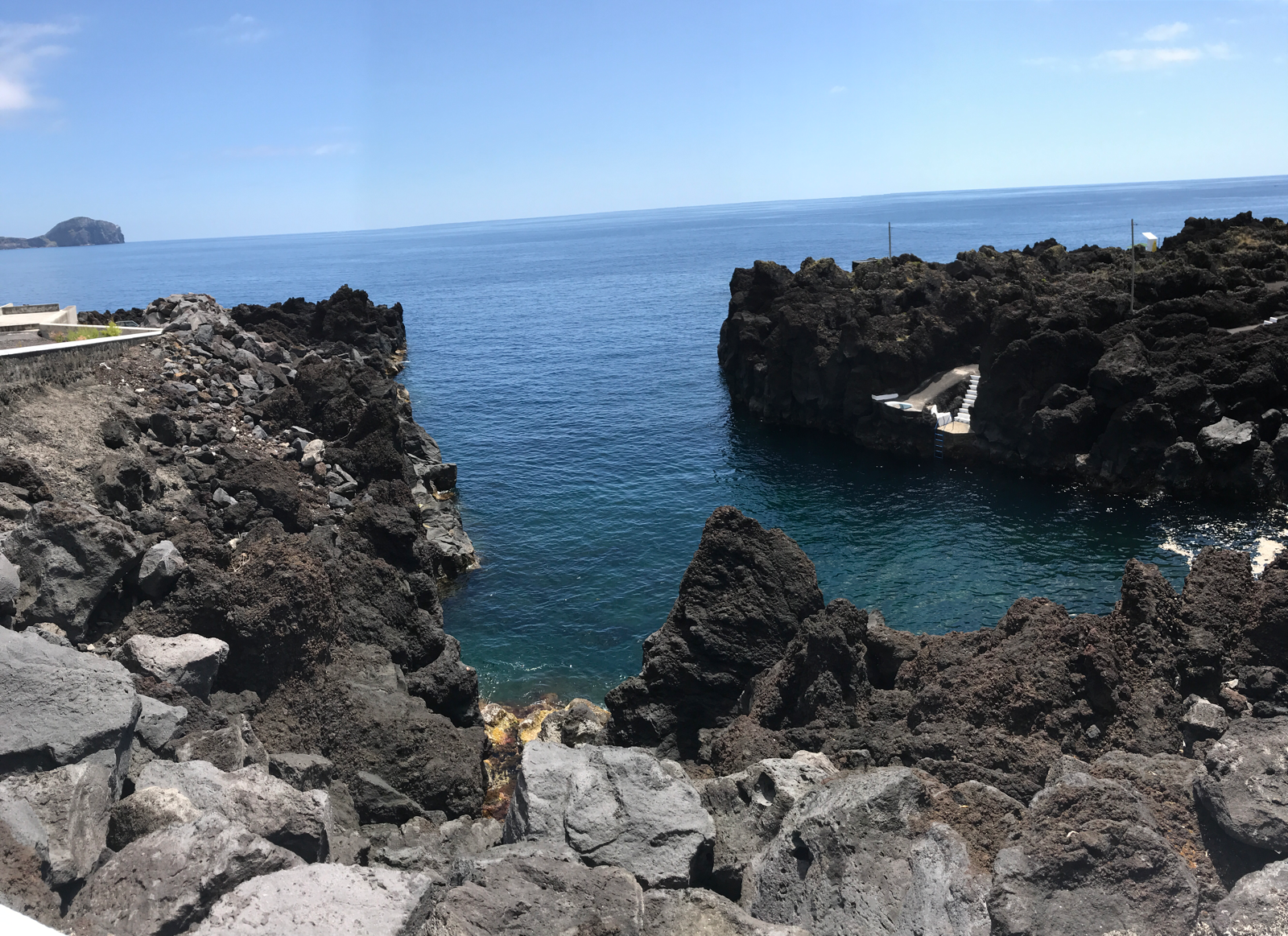
Phito 7 is a Cove where whalers launched their boats. It's shape didn't change after the 57-58 eruption. Today several ladders provide easy access to the sea for intrepid swimmers.
No comments:
Post a Comment